 vesseltracker.com
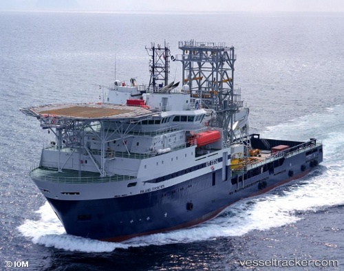
Island Frontier
Current StatusWhere is the vessel?
Island Frontier is currently in 94 nm S of Gulfmex Lightering Area, based on AIS data received about 1h ago.
Latest AIS update:
Current position: 26.19415° N, 91.02349° W (94 nm S of Gulfmex Lightering Area)
Average speed (last 7 days): Loading…
Average speed (last 30 days): Loading…
Vessel profile: Island Frontier is a Well Stimulation Vessel with dimensions 21m x 106m.
This page combines live AIS, route history, probable destination signals, nearby traffic, and port activity for practical vessel monitoring.
The current position of vessel Island Frontier is 26.19415 lat / -91.02349 lng. Updated: 2026-04-04 07:14:43 UTCNearest reference points:
- 94 nm S of Gulfmex Lightering Area
- 124 nm SW of Gulfmex Lightering Area
- 83 nm W of Gulfmex Lightering Area
Details:
Live Vessel Island Frontier Analytics (details, animations, etc.)
Recent AIS points (UTC):
2026-04-04 01:59:43 UTC · 26.28570, -91.02189 · SOG 1 kn · COG 176°2026-04-04 03:25:55 UTC · 26.26080, -91.02223 · SOG 1.1 kn · COG 175°
2026-04-04 06:08:21 UTC · 26.21380, -91.02345 · SOG 1 kn · COG 166°
2026-04-04 07:14:43 UTC · 26.19415, -91.02349 · SOG 1 kn · COG 166°