 vesseltracker.com
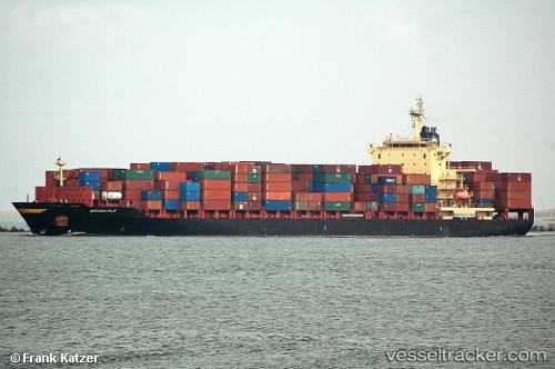
 Thorstar
Current Status
Where is the vessel?
Thorstar is currently in 46 nm NW of Krueng Geukueh, based on AIS data received about 3h ago.
Latest AIS update:
Current position: 5.81152° N, 96.52162° E (46 nm NW of Krueng Geukueh)
Average speed (last 7 days): Loading…
Average speed (last 30 days): Loading…
Vessel profile: Thorstar is a Container Ship with dimensions 222m x 30m.
This page combines live AIS, route history, probable destination signals, nearby traffic, and port activity for practical vessel monitoring.
The current position of vessel Thorstar is 5.81152 lat / 96.52162 lng. Updated: 2026-03-26 15:31:19 UTCNearest reference points:
- 45 nm NE of Krueng Geukueh
- 21 nm N of Sebang
- 53 nm NE of Sebang
Currently sailing under the flag of Liberia ![]()
Thorstar built in 2003 year
Deadweight:
39425 tDetails:
Live Vessel Thorstar Analytics (details, animations, etc.)
Recent AIS points (UTC):
2026-03-26 10:20:27 UTC · 5.76336, 96.44420 · SOG 1 kn · COG 113°2026-03-26 11:46:59 UTC · 5.75439, 96.42114 · SOG 0.8 kn · COG -1°
2026-03-26 14:01:28 UTC · 5.77541, 96.47031 · SOG 8.4 kn · COG 68°
2026-03-26 15:31:19 UTC · 5.81152, 96.52162 · SOG 0.5 kn · COG 13°