 vesseltracker.com
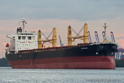
 MAREE
MAREE
Current Status
Where is the vessel?
MAREE is currently in 119 nm NE of Pinelands, based on AIS data received about 1h ago.
Latest AIS update:
Current position: 34.89148° N, 20.60047° E (119 nm NE of Pinelands)
Average speed (last 7 days): Loading…
Average speed (last 30 days): Loading…
Vessel profile: MAREE is a Bulk Carrier with dimensions m x m.
This page combines live AIS, route history, probable destination signals, nearby traffic, and port activity for practical vessel monitoring.
The current position of vessel MAREE is 34.89148 lat / 20.60047 lng. Updated: 2026-04-15 23:21:57 UTCNearest reference points:
- 61 nm N of Al Marj
- 85 nm W of Paleochora
- 23 nm S of Methoni
Currently sailing under the flag of Panama ![]()
Details:
Live Vessel MAREE Analytics (details, animations, etc.)
Recent AIS points (UTC):
2026-04-15 15:10:00 UTC · 34.25744, 19.24479 · SOG 10.1 kn · COG 53°2026-04-15 20:19:06 UTC · 34.68570, 20.15123 · SOG 9.4 kn · COG 62°
2026-04-15 21:35:52 UTC · 34.77704, 20.34917 · SOG 9.1 kn · COG -1°
2026-04-15 23:21:57 UTC · 34.89148, 20.60047 · SOG 9.8 kn · COG -1°