 vesseltracker.com
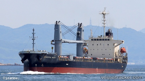
 JC RUBY
Current Status
Where is the vessel?
JC RUBY is currently in 15 nm NE of Marsalforn, based on AIS data received about 1d ago.
Latest AIS update:
Current position: 36.25242° N, 14.45062° E (15 nm NE of Marsalforn)
Average speed (last 7 days): Loading…
Average speed (last 30 days): Loading…
Vessel profile: JC RUBY is a Bulk Carrier with dimensions 135m x 135m.
This page combines live AIS, route history, probable destination signals, nearby traffic, and port activity for practical vessel monitoring.
The current position of vessel JC RUBY is 36.25242 lat / 14.45062 lng. Updated: 2026-04-10 07:23:36 UTCNearest reference points:
- 17 nm S of Marina di Ragusa
- Near CIRKEWWA
- Near Saint Julians
Currently sailing under the flag of Panama ![]()
JC RUBY built in 2002 year
Deadweight:
16732 tDetails:
Live Vessel JC RUBY Analytics (details, animations, etc.)
Recent AIS points (UTC):
2026-04-10 02:28:08 UTC · 36.26428, 15.34130 · SOG 9.4 kn · COG 266°2026-04-10 03:48:38 UTC · 36.25658, 15.08997 · SOG 8.8 kn · COG 276°
2026-04-10 06:01:29 UTC · 36.25445, 14.69492 · SOG 8.4 kn · COG 271°
2026-04-10 07:23:36 UTC · 36.25242, 14.45062 · SOG 8.8 kn · COG 268°