 vesseltracker.com
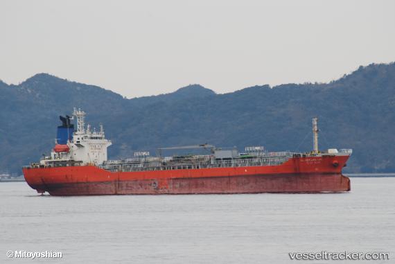
 LINK OCEAN 1
Current Status
Where is the vessel?
LINK OCEAN 1 is currently in Near Tanjung Perak, based on AIS data received about 1h ago.
Latest AIS update:
Current position: 7.19824° S, 112.71959° E (Near Tanjung Perak)
Average speed (last 7 days): Loading…
Average speed (last 30 days): Loading…
Vessel profile: LINK OCEAN 1 is a Tanker with dimensions m x m.
This page combines live AIS, route history, probable destination signals, nearby traffic, and port activity for practical vessel monitoring.
The current position of vessel LINK OCEAN 1 is -7.19824 lat / 112.71959 lng. Updated: 2026-04-13 15:29:49 UTCNearest reference points:
- Near Kalianak Barat
- Near Tanjung Perak
- Near Tanjong Perak
Currently sailing under the flag of Indonesia ![]()
Details:
Live Vessel LINK OCEAN 1 Analytics (details, animations, etc.)
Recent AIS points (UTC):
2026-04-13 09:56:38 UTC · -7.19823, 112.71958 · SOG 0 kn · COG 93°2026-04-13 11:50:42 UTC · -7.19820, 112.71958 · SOG 0 kn · COG 93°
2026-04-13 13:35:45 UTC · -7.19824, 112.71958 · SOG 0 kn · COG 93°
2026-04-13 15:29:49 UTC · -7.19824, 112.71959 · SOG 0 kn · COG 93°