 vesseltracker.com
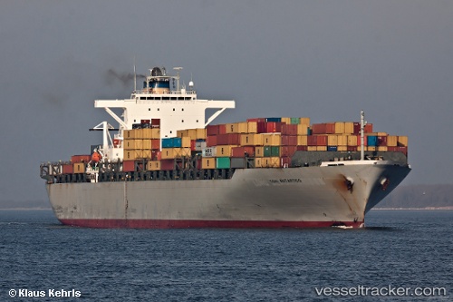
Ikaria
Current StatusWhere is the vessel?
Ikaria is currently in 142 nm SE of Porto Santo Island, based on AIS data received about 1h ago.
Latest AIS update:
Current position: 31.59826° N, 14.13599° W (142 nm SE of Porto Santo Island)
Average speed (last 7 days): Loading…
Average speed (last 30 days): Loading…
Vessel profile: Ikaria is a Container Ship with dimensions 40m x 279m.
This page combines live AIS, route history, probable destination signals, nearby traffic, and port activity for practical vessel monitoring.
The current position of vessel Ikaria is 31.59826 lat / -14.13599 lng. Updated: 2026-03-27 05:38:25 UTCNearest reference points:
- 148 nm SE of Porto Santo Island
- 109 nm E of Porto Santo Island
- 83 nm N of Caleta de Sebo
Details:
Live Vessel Ikaria Analytics (details, animations, etc.)
Recent AIS points (UTC):
2026-03-27 00:03:01 UTC · 33.20721, -13.72441 · SOG 17.4 kn · COG 194°2026-03-27 02:23:13 UTC · 32.54109, -13.89789 · SOG 17.6 kn · COG 192°
2026-03-27 04:04:07 UTC · 32.05742, -14.02056 · SOG 17.6 kn · COG 192°
2026-03-27 05:38:25 UTC · 31.59826, -14.13599 · SOG 17.8 kn · COG 191°