 vesseltracker.com
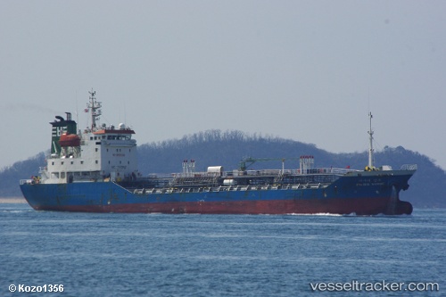
 Pacific Sambu
Current Status
Where is the vessel?
Pacific Sambu is currently in 13 nm NW of Taicang, based on AIS data received less than 1h ago.
Latest AIS update:
Current position: 31.76067° N, 120.99612° E (13 nm NW of Taicang)
Average speed (last 7 days): Loading…
Average speed (last 30 days): Loading…
Vessel profile: Pacific Sambu is a Chemical Oil Products Tanker with dimensions 91m x 14m.
This page combines live AIS, route history, probable destination signals, nearby traffic, and port activity for practical vessel monitoring.
The current position of vessel Pacific Sambu is 31.76067 lat / 120.99612 lng. Updated: 2026-04-12 07:48:26 UTCNearest reference points:
- 10 nm NW of Taicang
- 13 nm NE of Changshu Pt
- 11 nm NW of Taicang
Currently sailing under the flag of Korea ![]()
Details:
Live Vessel Pacific Sambu Analytics (details, animations, etc.)
Recent AIS points (UTC):
2026-04-10 05:44:51 UTC · 34.01750, 130.63875 · SOG 9.9 kn · COG 252°2026-04-10 08:18:44 UTC · 33.83278, 130.18840 · SOG 10.2 kn · COG 237°
2026-04-12 06:45:26 UTC · 31.76065, 120.99613 · SOG 0 kn · COG 282°
2026-04-12 07:48:26 UTC · 31.76067, 120.99612 · SOG 0 kn · COG 281°