 vesseltracker.com
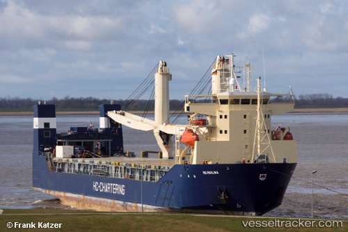
 SPARTA
Current Status
Where is the vessel?
SPARTA is currently in 34 nm NE of Milobadz, based on AIS data received less than 1h ago.
Latest AIS update:
Current position: 55.67330° N, 19.18026° E (34 nm NE of Milobadz)
Average speed (last 7 days): Loading…
Average speed (last 30 days): Loading…
Vessel profile: SPARTA is a Ro-Ro Cargo Ship with dimensions 142m x 23m.
This page combines live AIS, route history, probable destination signals, nearby traffic, and port activity for practical vessel monitoring.
The current position of vessel SPARTA is 55.67330 lat / 19.18026 lng. Updated: 2026-03-31 09:59:05 UTCNearest reference points:
- 39 nm W of Pilies juru uosto PVP/Klaipeda
- 17 nm W of Gusevka
- 10 nm NW of Svetlogorsk
Currently sailing under the flag of Russia ![]()
SPARTA built in 2003 year
Deadweight:
6785 tDetails:
Live Vessel SPARTA Analytics (details, animations, etc.)
Recent AIS points (UTC):
2026-03-31 03:29:55 UTC · 56.64551, 20.23568 · SOG 10.1 kn · COG 212°2026-03-31 06:13:45 UTC · 56.24869, 19.78503 · SOG 10.5 kn · COG 211°
2026-03-31 07:26:54 UTC · 56.06406, 19.57992 · SOG 10.7 kn · COG 212°
2026-03-31 09:59:05 UTC · 55.67330, 19.18026 · SOG 10.8 kn · COG 189°