 vesseltracker.com
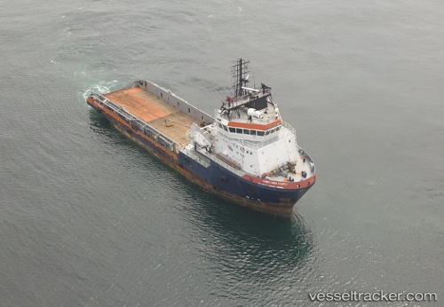
 HF HUNTER
Current Status
Where is the vessel?
HF HUNTER is currently in 21 nm S of Santa Cruz, based on AIS data received about 2h ago.
Latest AIS update:
Current position: 50.36213° S, 68.52173° W (21 nm S of Santa Cruz)
Average speed (last 7 days): Loading…
Average speed (last 30 days): Loading…
Vessel profile: HF HUNTER is a Anchor Handling Vessel with dimensions m x m.
This page combines live AIS, route history, probable destination signals, nearby traffic, and port activity for practical vessel monitoring.
The current position of vessel HF HUNTER is -50.36213 lat / -68.52173 lng. Updated: 2026-04-01 17:28:48 UTCNearest reference points:
- 13 nm NW of Rio Cullen
Currently sailing under the flag of Antigua and Barbuda ![]()
Details:
Live Vessel HF HUNTER Analytics (details, animations, etc.)
Recent AIS points (UTC):
2026-04-01 11:21:37 UTC · -50.11667, -68.40500 · SOG 0 kn · COG -1°2026-04-01 13:56:21 UTC · -50.11775, -68.40169 · SOG 7 kn · COG 89°
2026-04-01 15:50:35 UTC · -50.24289, -68.36736 · SOG 5.7 kn · COG 228°
2026-04-01 17:28:48 UTC · -50.36213, -68.52173 · SOG 5.6 kn · COG 224°