 vesseltracker.com
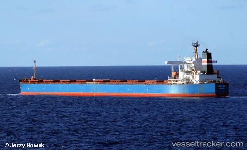
 Cape Aria
Current Status
Where is the vessel?
Cape Aria is currently in 252 nm E of Diego Garcia, based on AIS data received about 2h ago.
Latest AIS update:
Current position: 8.54345° S, 76.51887° E (252 nm E of Diego Garcia)
Average speed (last 7 days): Loading…
Average speed (last 30 days): Loading…
Vessel profile: Cape Aria is a Bulk Carrier with dimensions 289m x 45m.
This page combines live AIS, route history, probable destination signals, nearby traffic, and port activity for practical vessel monitoring.
The current position of vessel Cape Aria is -8.54345 lat / 76.51887 lng. Updated: 2026-03-27 21:59:07 UTCNearest reference points:
- 284 nm E of Diego Garcia
- 208 nm E of Diego Garcia
- Open sea, approx. 401 nm off the nearest listed port
Currently sailing under the flag of Liberia ![]()
Cape Aria built in 2005 year
Deadweight:
176346 tDetails:
Live Vessel Cape Aria Analytics (details, animations, etc.)
Recent AIS points (UTC):
2026-03-27 16:12:59 UTC · -7.86498, 77.38942 · SOG 11.3 kn · COG 232°2026-03-27 17:55:58 UTC · -8.06562, 77.13455 · SOG 11.1 kn · COG 232°
2026-03-27 19:25:27 UTC · -8.23483, 76.91118 · SOG 11.2 kn · COG 231°
2026-03-27 21:59:07 UTC · -8.54345, 76.51887 · SOG 11.8 kn · COG 231°