 vesseltracker.com
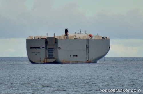
 Texas Highway
Current Status
Where is the vessel?
Texas Highway is currently in 84 nm E of Dolni Kounice, based on AIS data received less than 1h ago.
Latest AIS update:
Current position: 49.26344° N, 165.39555° E (84 nm E of Dolni Kounice)
Average speed (last 7 days): Loading…
Average speed (last 30 days): Loading…
Vessel profile: Texas Highway is a Vehicles Carrier with dimensions 199m x 199m.
This page combines live AIS, route history, probable destination signals, nearby traffic, and port activity for practical vessel monitoring.
The current position of vessel Texas Highway is 49.26344 lat / 165.39555 lng. Updated: 2026-03-29 16:23:37 UTCCurrently sailing under the flag of Japan ![]()
Texas Highway built in 2003 year
Deadweight:
17481 tDetails:
Live Vessel Texas Highway Analytics (details, animations, etc.)
Recent AIS points (UTC):
2026-03-29 09:28:20 UTC · 48.38009, 162.96648 · SOG 15.8 kn · COG 60°2026-03-29 12:00:43 UTC · 48.70243, 163.84830 · SOG 15.9 kn · COG 59°
2026-03-29 13:25:52 UTC · 48.88397, 164.34422 · SOG 15.9 kn · COG 60°
2026-03-29 16:23:37 UTC · 49.26344, 165.39555 · SOG 15.9 kn · COG 61°