 vesseltracker.com
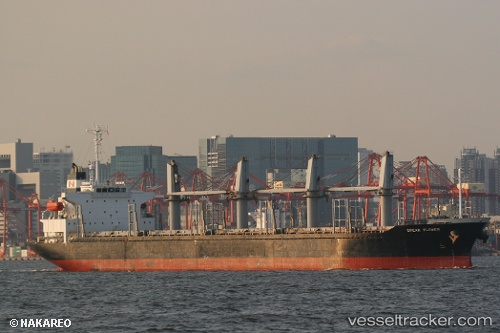
 AK KARAM
Current Status
Where is the vessel?
AK KARAM is currently in Near Annaba, based on AIS data received about 1d ago.
Latest AIS update:
Current position: 36.90247° N, 7.77132° E (Near Annaba)
Average speed (last 7 days): Loading…
Average speed (last 30 days): Loading…
Vessel profile: AK KARAM is a Bulk Carrier with dimensions m x m.
This page combines live AIS, route history, probable destination signals, nearby traffic, and port activity for practical vessel monitoring.
The current position of vessel AK KARAM is 36.90247 lat / 7.77132 lng. Updated: 2026-04-10 07:22:43 UTCNearest reference points:
- Near Annaba
- Near Skikid
- 35 nm S of Setubal
Currently sailing under the flag of Barbados ![]()
Details:
Live Vessel AK KARAM Analytics (details, animations, etc.)
Recent AIS points (UTC):
2026-04-10 02:22:44 UTC · 36.90258, 7.77130 · SOG 0 kn · COG 48°2026-04-10 03:46:43 UTC · 36.90248, 7.77128 · SOG 0 kn · COG 47°
2026-04-10 05:58:43 UTC · 36.90248, 7.77129 · SOG 0 kn · COG 48°
2026-04-10 07:22:43 UTC · 36.90247, 7.77132 · SOG 0 kn · COG 47°