 vesseltracker.com
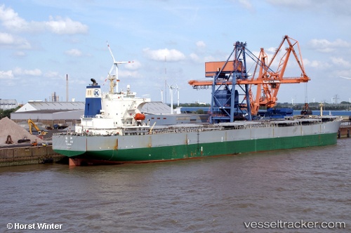
 TANHO
TANHO
Current Status
Where is the vessel?
TANHO is currently in Near Ashdod Bonded, based on AIS data received about 1d ago.
Latest AIS update:
Current position: 31.82775° N, 34.64520° E (Near Ashdod Bonded)
Average speed (last 7 days): Loading…
Average speed (last 30 days): Loading…
Vessel profile: TANHO is a Dredging or underwater ops with dimensions m x m.
This page combines live AIS, route history, probable destination signals, nearby traffic, and port activity for practical vessel monitoring.
The current position of vessel TANHO is 31.82775 lat / 34.64520 lng. Updated: 2026-04-16 11:53:48 UTCNearest reference points:
- Near Haifa
- Near AL ARISH
- 22 nm W of Haifa Granaries
Currently sailing under the flag of Sao Tome and Principe ![]()
Details:
Live Vessel TANHO Analytics (details, animations, etc.)
Recent AIS points (UTC):
2026-04-15 16:27:20 UTC · 31.82862, 34.64531 · SOG 0.4 kn · COG 118°2026-04-15 16:27:20 UTC · 31.82862, 34.64531 · SOG 0.4 kn · COG 118°
2026-04-16 11:53:48 UTC · 31.82775, 34.64520 · SOG 0.3 kn · COG 117°
2026-04-16 11:53:48 UTC · 31.82775, 34.64520 · SOG 0.3 kn · COG 117°