 vesseltracker.com
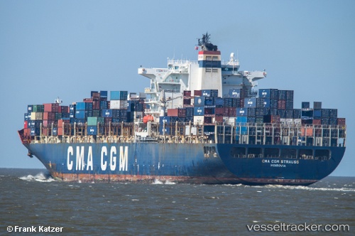
 GSL CHRISTEL ELISABETH
Current Status
Where is the vessel?
GSL CHRISTEL ELISABETH is currently in 95 nm SW of CLARK'S HARBOUR, based on AIS data received about 1h ago.
Latest AIS update:
Current position: 42.30151° N, 67.12296° W (95 nm SW of CLARK'S HARBOUR)
Average speed (last 7 days): Loading…
Average speed (last 30 days): Loading…
Vessel profile: GSL CHRISTEL ELISABETH is a Container Ship with dimensions 277m x 40m.
This page combines live AIS, route history, probable destination signals, nearby traffic, and port activity for practical vessel monitoring.
The current position of vessel GSL CHRISTEL ELISABETH is 42.30151 lat / -67.12296 lng. Updated: 2026-04-18 17:48:37 UTCNearest reference points:
- Near Wedgeport
- Near Lower Woods Harbour
- 16 nm W of Tiverton
Currently sailing under the flag of Liberia ![]()
GSL CHRISTEL ELISABETH built in 2004 year
Deadweight:
73235 tDetails:
Live Vessel GSL CHRISTEL ELISABETH Analytics (details, animations, etc.)
Recent AIS points (UTC):
2026-04-18 11:41:34 UTC · 43.45084, -67.27944 · SOG 12.3 kn · COG 194°2026-04-18 13:53:21 UTC · 43.02667, -67.45333 · SOG 11 kn · COG -1°
2026-04-18 16:14:18 UTC · 42.58667, -67.28333 · SOG 11 kn · COG -1°
2026-04-18 17:48:37 UTC · 42.30151, -67.12296 · SOG 11.8 kn · COG 149°