 vesseltracker.com
 ROUTE
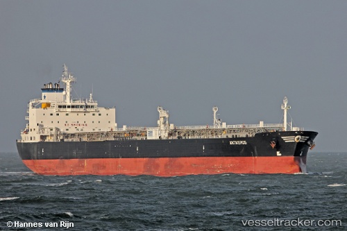
ROUTE
Current Status
Where is the vessel?
ROUTE is currently in 22 nm W of Sagres, based on AIS data received less than 1h ago.
Latest AIS update:
Current position: 37.06668° N, 9.37875° W (22 nm W of Sagres)
Average speed (last 7 days): Loading…
Average speed (last 30 days): Loading…
Vessel profile: ROUTE is a Crude Oil Tanker with dimensions 228m x 32m.
This page combines live AIS, route history, probable destination signals, nearby traffic, and port activity for practical vessel monitoring.
The current position of vessel ROUTE is 37.06668 lat / -9.37875 lng. Updated: 2026-04-03 15:49:53 UTCNearest reference points:
- 31 nm SW of Sagres
- 18 nm S of Sagres
- 54 nm W of Sagres
Currently sailing under the flag of Barbados ![]()
ROUTE built in 2004 year
Deadweight:
69714 tDetails:
Live Vessel ROUTE Analytics (details, animations, etc.)
Recent AIS points (UTC):
2026-04-03 10:01:34 UTC · 36.48998, -8.19515 · SOG 13 kn · COG 289°2026-04-03 11:29:54 UTC · 36.58692, -8.56572 · SOG 12.4 kn · COG 287°
2026-04-03 13:46:54 UTC · 36.73308, -9.12018 · SOG 12.3 kn · COG 293°
2026-04-03 15:49:53 UTC · 37.06668, -9.37875 · SOG 12.1 kn · COG 349°