 vesseltracker.com
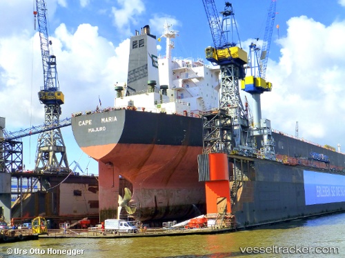
Cape Maria
Current StatusWhere is the vessel?
Cape Maria is currently in 11 nm SW of Port de Boké, based on AIS data received about 1h ago.
Latest AIS update:
Current position: 10.41467° N, 14.87790° W (11 nm SW of Port de Boké)
Average speed (last 7 days): Loading…
Average speed (last 30 days): Loading…
Vessel profile: Cape Maria is a Bulk Carrier with dimensions 47m x 289m.
This page combines live AIS, route history, probable destination signals, nearby traffic, and port activity for practical vessel monitoring.
The current position of vessel Cape Maria is 10.41467 lat / -14.87790 lng. Updated: 2026-04-09 15:30:15 UTCNearest reference points:
- Near Port de Boké
- 14 nm S of Port de Boké
- Near Dougoula
Details:
Live Vessel Cape Maria Analytics (details, animations, etc.)
Recent AIS points (UTC):
2026-04-09 09:52:47 UTC · 10.41833, -14.87500 · SOG 0 kn · COG -1°2026-04-09 11:43:45 UTC · 10.41833, -14.87667 · SOG 0 kn · COG -1°
2026-04-09 13:45:14 UTC · 10.41858, -14.87965 · SOG 0.1 kn · COG 135°
2026-04-09 15:30:15 UTC · 10.41467, -14.87790 · SOG 0.2 kn · COG 16°