 vesseltracker.com
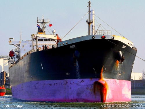
 ILAN
ILAN
Current Status
Where is the vessel?
ILAN is currently in Near Jorf Lasfar, based on AIS data received less than 1h ago.
Latest AIS update:
Current position: 33.18230° N, 8.72721° W (Near Jorf Lasfar)
Average speed (last 7 days): Loading…
Average speed (last 30 days): Loading…
Vessel profile: ILAN is a Oil Products Tanker with dimensions m x m.
This page combines live AIS, route history, probable destination signals, nearby traffic, and port activity for practical vessel monitoring.
The current position of vessel ILAN is 33.18230 lat / -8.72721 lng. Updated: 2026-04-03 10:01:31 UTCNearest reference points:
- Near Jorf Lasfar
- 21 nm NW of El Jadida
- 44 nm NW of El Jadida
Currently sailing under the flag of Liberia ![]()
Details:
Live Vessel ILAN Analytics (details, animations, etc.)
Recent AIS points (UTC):
2026-04-03 03:28:31 UTC · 33.18262, -8.72879 · SOG 0 kn · COG 39°2026-04-03 05:31:33 UTC · 33.18259, -8.72837 · SOG 0.2 kn · COG 34°
2026-04-03 07:25:31 UTC · 33.18250, -8.72824 · SOG 0.2 kn · COG 27°
2026-04-03 10:01:31 UTC · 33.18230, -8.72721 · SOG 0.1 kn · COG 11°