 vesseltracker.com
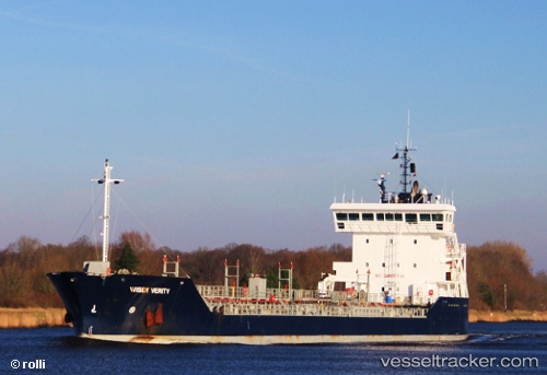
 NORTHERN OSPREY
Current Status
Where is the vessel?
NORTHERN OSPREY is currently in 13 nm S of BRIGHTON MARINA, based on AIS data received about 2h ago.
Latest AIS update:
Current position: 50.61006° N, 0.22326° W (13 nm S of BRIGHTON MARINA)
Average speed (last 7 days): Loading…
Average speed (last 30 days): Loading…
Vessel profile: NORTHERN OSPREY is a Oil Products Tanker with dimensions m x m.
This page combines live AIS, route history, probable destination signals, nearby traffic, and port activity for practical vessel monitoring.
The current position of vessel NORTHERN OSPREY is 50.61006 lat / -0.22326 lng. Updated: 2026-03-31 15:21:59 UTCNearest reference points:
- 23 nm S of Ferring
- 27 nm S of Seaford
- Near CHICHESTER
Currently sailing under the flag of Panama ![]()
Details:
Live Vessel NORTHERN OSPREY Analytics (details, animations, etc.)
Recent AIS points (UTC):
2026-03-31 09:41:18 UTC · 50.59124, -0.23069 · SOG 0 kn · COG 254°2026-03-31 11:25:09 UTC · 50.59147, -0.23098 · SOG 0 kn · COG 253°
2026-03-31 14:16:49 UTC · 50.58867, -0.22833 · SOG 4.9 kn · COG 30°
2026-03-31 15:21:59 UTC · 50.61006, -0.22326 · SOG 0 kn · COG 95°