 vesseltracker.com
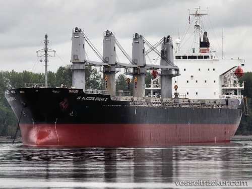
 DREAM
DREAM
Current Status
Where is the vessel?
DREAM is currently in Near TUZLA, based on AIS data received less than 1h ago.
Latest AIS update:
Current position: 40.84328° N, 29.23803° E (Near TUZLA)
Average speed (last 7 days): Loading…
Average speed (last 30 days): Loading…
Vessel profile: DREAM is a Bulk Carrier with dimensions m x m.
This page combines live AIS, route history, probable destination signals, nearby traffic, and port activity for practical vessel monitoring.
The current position of vessel DREAM is 40.84328 lat / 29.23803 lng. Updated: 2026-03-29 05:32:41 UTCNearest reference points:
- Near TUZLA
- Near PENDIK
- Near Tuzla Free Zone
Currently sailing under the flag of Saint Kitts and Nevis ![]()
Details:
Live Vessel DREAM Analytics (details, animations, etc.)
Recent AIS points (UTC):
2026-03-28 23:23:39 UTC · 40.84155, 29.23483 · SOG 0 kn · COG 40°2026-03-29 01:05:42 UTC · 40.84185, 29.23448 · SOG 0 kn · COG 60°
2026-03-29 04:05:40 UTC · 40.84303, 29.23820 · SOG 0.1 kn · COG 256°
2026-03-29 05:32:41 UTC · 40.84328, 29.23803 · SOG 0 kn · COG 245°