 vesseltracker.com
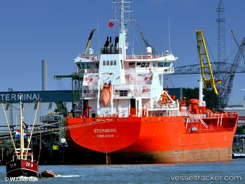
 STENBERG
Current Status
Where is the vessel?
STENBERG is currently in 27 nm SW of Seaford, based on AIS data received less than 1h ago.
Latest AIS update:
Current position: 50.35717° N, 0.17830° W (27 nm SW of Seaford)
Average speed (last 7 days): Loading…
Average speed (last 30 days): Loading…
Vessel profile: STENBERG is a Oil/Chemical Tanker with dimensions m x m.
This page combines live AIS, route history, probable destination signals, nearby traffic, and port activity for practical vessel monitoring.
The current position of vessel STENBERG is 50.35717 lat / -0.17830 lng. Updated: 2026-03-29 14:19:06 UTCNearest reference points:
- 27 nm S of Seaford
- 23 nm S of Ferring
- 15 nm S of Selsey
Currently sailing under the flag of Portugal ![]()
Details:
Live Vessel STENBERG Analytics (details, animations, etc.)
Recent AIS points (UTC):
2026-03-29 08:23:45 UTC · 50.81412, -1.29324 · SOG 13 kn · COG 149°2026-03-29 09:49:20 UTC · 50.70946, -0.98286 · SOG 9.7 kn · COG 137°
2026-03-29 11:38:02 UTC · 50.56434, -0.76651 · SOG 9 kn · COG 101°
2026-03-29 14:19:06 UTC · 50.35717, -0.17830 · SOG 10 kn · COG 114°