 vesseltracker.com
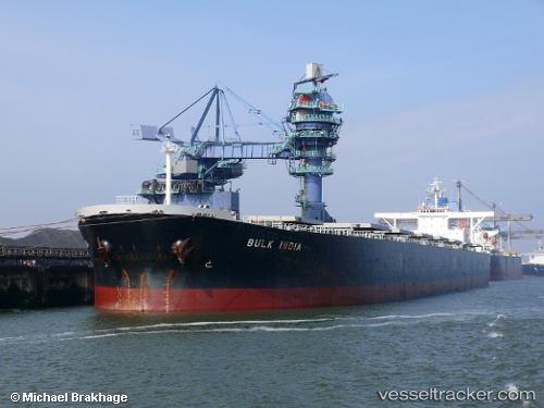
 BULK ARA
Current Status
Where is the vessel?
BULK ARA is currently in 136 nm W of Laoag, Luzon, based on AIS data received less than 1h ago.
Latest AIS update:
Current position: 18.97652° N, 118.33642° E (136 nm W of Laoag, Luzon)
Average speed (last 7 days): Loading…
Average speed (last 30 days): Loading…
Vessel profile: BULK ARA is a Bulk Carrier with dimensions m x m.
This page combines live AIS, route history, probable destination signals, nearby traffic, and port activity for practical vessel monitoring.
The current position of vessel BULK ARA is 18.97652 lat / 118.33642 lng. Updated: 2026-04-17 15:43:25 UTCNearest reference points:
- 138 nm NW of Bolinao
- 148 nm SE of Xijiang
- 132 nm SW of Kaohsiung
Currently sailing under the flag of Marshall Islands ![]()
Details:
Live Vessel BULK ARA Analytics (details, animations, etc.)
Recent AIS points (UTC):
2026-04-17 11:58:43 UTC · 18.43018, 117.81813 · SOG 12.2 kn · COG 37°2026-04-17 13:26:56 UTC · 18.65558, 118.02873 · SOG 11.8 kn · COG 43°
2026-04-17 15:43:25 UTC · 18.97652, 118.33642 · SOG 11.6 kn · COG 44°
2026-04-17 15:43:25 UTC · 18.97652, 118.33642 · SOG 11.6 kn · COG 44°