 vesseltracker.com
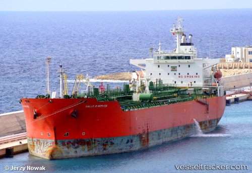
 CHERRY TONDA
Current Status
Where is the vessel?
CHERRY TONDA is currently in 14 nm W of TANJUNG PELEPAS, based on AIS data received about 1h ago.
Latest AIS update:
Current position: 1.27767° N, 103.31767° E (14 nm W of TANJUNG PELEPAS)
Average speed (last 7 days): Loading…
Average speed (last 30 days): Loading…
Vessel profile: CHERRY TONDA is a Chemical Oil Products Tanker with dimensions 176m x 31m.
This page combines live AIS, route history, probable destination signals, nearby traffic, and port activity for practical vessel monitoring.
The current position of vessel CHERRY TONDA is 1.27767 lat / 103.31767 lng. Updated: 2026-04-07 20:14:54 UTCNearest reference points:
- 15 nm W of Tanjong Bin
- 19 nm W of Tanjong Bin
- Near Tanjungbalai
Currently sailing under the flag of Panama ![]()
Details:
Live Vessel CHERRY TONDA Analytics (details, animations, etc.)
Recent AIS points (UTC):
2026-04-07 13:33:50 UTC · 1.92417, 102.19833 · SOG 13.8 kn · COG 134°2026-04-07 15:36:12 UTC · 1.72483, 102.61117 · SOG 14.3 kn · COG 109°
2026-04-07 18:08:43 UTC · 1.48866, 103.03467 · SOG 10.4 kn · COG 114°
2026-04-07 20:14:54 UTC · 1.27767, 103.31767 · SOG 10 kn · COG 126°