 vesseltracker.com
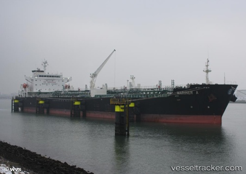
 Mariner A
Current Status
Where is the vessel?
Mariner A is currently in Near Apapa, based on AIS data received about 4h ago.
Latest AIS update:
Current position: 6.35746° N, 3.38884° E (Near Apapa)
Average speed (last 7 days): Loading…
Average speed (last 30 days): Loading…
Vessel profile: Mariner A is a Chemical Oil Products Tanker with dimensions 176m x 31m.
This page combines live AIS, route history, probable destination signals, nearby traffic, and port activity for practical vessel monitoring.
The current position of vessel Mariner A is 6.35746 lat / 3.38884 lng. Updated: 2026-04-10 07:23:23 UTCNearest reference points:
- Near Lagos
- Near Apapa
- Near Kirikiri
Currently sailing under the flag of Malta ![]()
Mariner A built in 2005 year
Deadweight:
40099 tDetails:
Live Vessel Mariner A Analytics (details, animations, etc.)
Recent AIS points (UTC):
2026-04-10 02:23:23 UTC · 6.35785, 3.38892 · SOG 0.1 kn · COG 81°2026-04-10 03:47:27 UTC · 6.35781, 3.38925 · SOG 0.1 kn · COG 73°
2026-04-10 05:59:23 UTC · 6.35741, 3.38885 · SOG 0.1 kn · COG 71°
2026-04-10 07:23:23 UTC · 6.35746, 3.38884 · SOG 0.1 kn · COG 75°