 vesseltracker.com
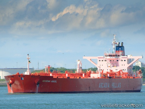
 LADY LOUISE
Current Status
Where is the vessel?
LADY LOUISE is currently in 91 nm E of 'Adan, based on AIS data received less than 1h ago.
Latest AIS update:
Current position: 12.31370° N, 46.50675° E (91 nm E of 'Adan)
Average speed (last 7 days): Loading…
Average speed (last 30 days): Loading…
Vessel profile: LADY LOUISE is a Crude Oil Tanker with dimensions m x m.
This page combines live AIS, route history, probable destination signals, nearby traffic, and port activity for practical vessel monitoring.
The current position of vessel LADY LOUISE is 12.31370 lat / 46.50675 lng. Updated: 2026-04-08 13:43:58 UTCCurrently sailing under the flag of Panama ![]()
Details:
Live Vessel LADY LOUISE Analytics (details, animations, etc.)
Recent AIS points (UTC):
2026-04-08 07:45:09 UTC · 11.91887, 45.24392 · SOG 12.3 kn · COG 74°2026-04-08 09:44:45 UTC · 12.04342, 45.65150 · SOG 12.7 kn · COG 70°
2026-04-08 11:42:18 UTC · 12.17203, 46.06497 · SOG 13.2 kn · COG 69°
2026-04-08 13:43:58 UTC · 12.31370, 46.50675 · SOG 13.4 kn · COG 71°