 vesseltracker.com
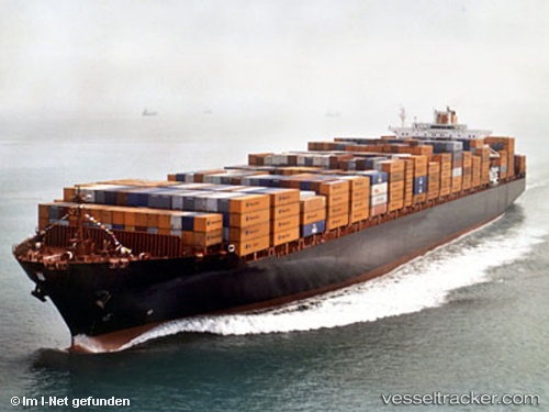
 OYKU A
Current Status
Where is the vessel?
OYKU A is currently in Near GEMLIK, based on AIS data received about 2h ago.
Latest AIS update:
Current position: 40.41382° N, 29.07749° E (Near GEMLIK)
Average speed (last 7 days): Loading…
Average speed (last 30 days): Loading…
Vessel profile: OYKU A is a Container Ship with dimensions m x m.
This page combines live AIS, route history, probable destination signals, nearby traffic, and port activity for practical vessel monitoring.
The current position of vessel OYKU A is 40.41382 lat / 29.07749 lng. Updated: 2026-03-28 19:39:27 UTCNearest reference points:
- Near GEMLIK
- 14 nm SW of Maltepe
- 11 nm S of Maltepe
Currently sailing under the flag of Turkey ![]()
Details:
Live Vessel OYKU A Analytics (details, animations, etc.)
Recent AIS points (UTC):
2026-03-28 13:28:59 UTC · 40.43944, 28.73564 · SOG 13.1 kn · COG 90°2026-03-28 15:38:29 UTC · 40.42921, 29.06129 · SOG 2.5 kn · COG 140°
2026-03-28 18:09:27 UTC · 40.41380, 29.07749 · SOG 0 kn · COG 269°
2026-03-28 19:39:27 UTC · 40.41382, 29.07749 · SOG 0 kn · COG 270°