 vesseltracker.com
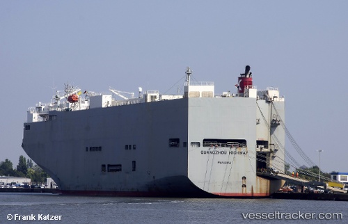
Guangzou Highway
Current StatusWhere is the vessel?
Guangzou Highway is currently in 177 nm SE of Preobrazheniye, based on AIS data received less than 1h ago.
Latest AIS update:
Current position: 40.31479° N, 135.80872° E (177 nm SE of Preobrazheniye)
Average speed (last 7 days): Loading…
Average speed (last 30 days): Loading…
Vessel profile: Guangzou Highway is a Vehicles Carrier with dimensions 40m x 180m.
This page combines live AIS, route history, probable destination signals, nearby traffic, and port activity for practical vessel monitoring.
The current position of vessel Guangzou Highway is 40.31479 lat / 135.80872 lng. Updated: 2026-04-03 08:06:31 UTCNearest reference points:
- 63 nm NW of Sado Shima Apt
- 46 nm SE of Vrangel'
- 29 nm SE of Vrangel'
Details:
Live Vessel Guangzou Highway Analytics (details, animations, etc.)
Recent AIS points (UTC):
2026-04-03 00:02:11 UTC · 40.30033, 135.56931 · SOG 0.9 kn · COG 321°2026-04-03 02:54:44 UTC · 40.30879, 135.61551 · SOG 1 kn · COG -1°
2026-04-03 05:45:24 UTC · 40.31237, 135.71271 · SOG 2 kn · COG 297°
2026-04-03 08:06:31 UTC · 40.31479, 135.80872 · SOG 1.8 kn · COG 298°