 vesseltracker.com
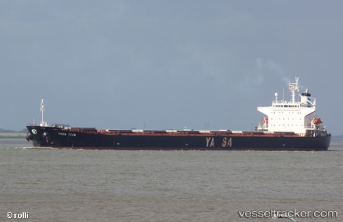
 OCEAN BRIGHT
Current Status
Where is the vessel?
OCEAN BRIGHT is currently in 31 nm E of Tan Cang Qui Nhon, based on AIS data received about 2h ago.
Latest AIS update:
Current position: 13.88648° N, 110.35318° E (31 nm E of Tan Cang Qui Nhon)
Average speed (last 7 days): Loading…
Average speed (last 30 days): Loading…
Vessel profile: OCEAN BRIGHT is a Bulk Carrier with dimensions m x m.
This page combines live AIS, route history, probable destination signals, nearby traffic, and port activity for practical vessel monitoring.
The current position of vessel OCEAN BRIGHT is 13.88648 lat / 110.35318 lng. Updated: 2026-04-02 13:07:41 UTCNearest reference points:
- 29 nm NE of Vung Ro
- Near Bong Son
- 17 nm NE of Bong Son
Currently sailing under the flag of Liberia ![]()
Details:
Live Vessel OCEAN BRIGHT Analytics (details, animations, etc.)
Recent AIS points (UTC):
2026-04-02 00:05:11 UTC · 16.45284, 111.03990 · SOG 11.4 kn · COG 194°2026-04-02 11:44:46 UTC · 14.15872, 110.42003 · SOG 11.9 kn · COG 193°
2026-04-02 13:07:41 UTC · 13.88648, 110.35318 · SOG 12.2 kn · COG 193°
2026-04-02 13:07:41 UTC · 13.88648, 110.35318 · SOG 12.2 kn · COG 193°