 vesseltracker.com
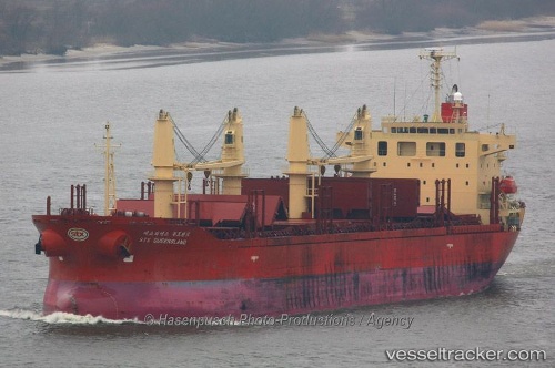
 LADY BABU
Current Status
Where is the vessel?
LADY BABU is currently in 13 nm SW of Douala, based on AIS data received less than 1h ago.
Latest AIS update:
Current position: 3.89258° N, 9.53338° E (13 nm SW of Douala)
Average speed (last 7 days): Loading…
Average speed (last 30 days): Loading…
Vessel profile: LADY BABU is a Bulk Carrier with dimensions m x m.
This page combines live AIS, route history, probable destination signals, nearby traffic, and port activity for practical vessel monitoring.
The current position of vessel LADY BABU is 3.89258 lat / 9.53338 lng. Updated: 2026-04-21 08:01:30 UTCNearest reference points:
- Near Victoria
- Near Moudi Terminal
- Near Calabar
Currently sailing under the flag of Panama ![]()
Details:
Live Vessel LADY BABU Analytics (details, animations, etc.)
Recent AIS points (UTC):
2026-04-21 04:16:18 UTC · 3.54890, 9.36640 · SOG 12 kn · COG 10°2026-04-21 06:24:03 UTC · 3.89008, 9.52038 · SOG 5.4 kn · COG 46°
2026-04-21 07:55:30 UTC · 3.89277, 9.53350 · SOG 0 kn · COG 272°
2026-04-21 08:01:30 UTC · 3.89258, 9.53338 · SOG 0 kn · COG 270°