 vesseltracker.com
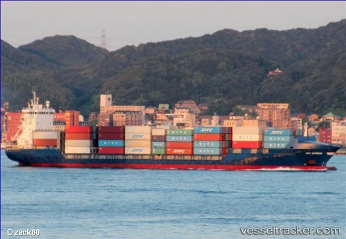
 CHS ALPHA
Current Status
Where is the vessel?
CHS ALPHA is currently in 94 nm SE of Kárpathos, based on AIS data received about 1d ago.
Latest AIS update:
Current position: 34.59118° N, 28.78430° E (94 nm SE of Kárpathos)
Average speed (last 7 days): Loading…
Average speed (last 30 days): Loading…
Vessel profile: CHS ALPHA is a Container Ship with dimensions m x m.
This page combines live AIS, route history, probable destination signals, nearby traffic, and port activity for practical vessel monitoring.
The current position of vessel CHS ALPHA is 34.59118 lat / 28.78430 lng. Updated: 2026-04-10 06:21:15 UTCNearest reference points:
- 108 nm S of Kastellorizou (ex Megísti)
- 129 nm NW of ABU QIR
- 91 nm SE of Polychnitos Lesvou
Currently sailing under the flag of Antigua and Barbuda ![]()
Details:
Live Vessel CHS ALPHA Analytics (details, animations, etc.)
Recent AIS points (UTC):
2026-04-10 02:08:03 UTC · 35.26168, 28.02986 · SOG 13 kn · COG 136°2026-04-10 02:08:03 UTC · 35.26168, 28.02986 · SOG 13 kn · COG 136°
2026-04-10 04:38:25 UTC · 34.86632, 28.47585 · SOG 13 kn · COG 140°
2026-04-10 06:21:15 UTC · 34.59118, 28.78430 · SOG 13 kn · COG 138°