 vesseltracker.com
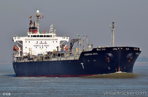
Chemroad Haya
Current StatusWhere is the vessel?
Chemroad Haya is currently in 44 nm SW of Tirur, based on AIS data received about 1h ago.
Latest AIS update:
Current position: 10.54812° N, 75.26083° E (44 nm SW of Tirur)
Average speed (last 7 days): Loading…
Average speed (last 30 days): Loading…
Vessel profile: Chemroad Haya is a Chemical Oil Products Tanker with dimensions 29m x 175m.
This page combines live AIS, route history, probable destination signals, nearby traffic, and port activity for practical vessel monitoring.
The current position of vessel Chemroad Haya is 10.54812 lat / 75.26083 lng. Updated: 2026-04-01 20:18:31 UTCNearest reference points:
- Near Cochin
- Near Edappally
- 45 nm SW of Kalpeni Island
Details:
Live Vessel Chemroad Haya Analytics (details, animations, etc.)
Recent AIS points (UTC):
2026-04-01 13:31:27 UTC · 12.05465, 74.84166 · SOG 13.8 kn · COG -1°2026-04-01 16:03:27 UTC · 11.48641, 74.99704 · SOG 13.6 kn · COG 164°
2026-04-01 16:03:27 UTC · 11.48641, 74.99704 · SOG 13.6 kn · COG 164°
2026-04-01 20:18:31 UTC · 10.54812, 75.26083 · SOG 13.9 kn · COG 167°