 vesseltracker.com
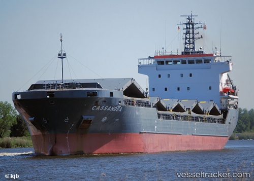
 TYPHOON EXPRESS
Current Status
Where is the vessel?
TYPHOON EXPRESS is currently in Near Saint John's, based on AIS data received about 6h ago.
Latest AIS update:
Current position: 17.12458° N, 61.85394° W (Near Saint John's)
Average speed (last 7 days): Loading…
Average speed (last 30 days): Loading…
Vessel profile: TYPHOON EXPRESS is a General Cargo with dimensions m x m.
This page combines live AIS, route history, probable destination signals, nearby traffic, and port activity for practical vessel monitoring.
The current position of vessel TYPHOON EXPRESS is 17.12458 lat / -61.85394 lng. Updated: 2026-03-31 21:47:47 UTCNearest reference points:
- Near Saint John's
- Near ANTIGUA
- Near Pointe A Pitre
Currently sailing under the flag of Antigua and Barbuda ![]()
Details:
Live Vessel TYPHOON EXPRESS Analytics (details, animations, etc.)
Recent AIS points (UTC):
2026-03-31 20:11:18 UTC · 17.12863, -61.89567 · SOG 12.9 kn · COG -1°2026-03-31 21:47:47 UTC · 17.12458, -61.85394 · SOG 0 kn · COG -1°
2026-03-31 21:47:47 UTC · 17.12458, -61.85394 · SOG 0 kn · COG -1°
2026-03-31 21:47:47 UTC · 17.12458, -61.85394 · SOG 0 kn · COG -1°