 vesseltracker.com
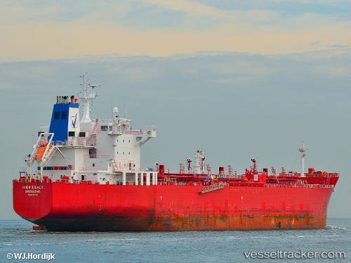
 Idi
Idi
Current Status
Where is the vessel?
Idi is currently in 69 nm SW of Abakaliki, based on AIS data received less than 1h ago.
Latest AIS update:
Current position: 5.61087° N, 85.09747° E (69 nm SW of Abakaliki)
Average speed (last 7 days): Loading…
Average speed (last 30 days): Loading…
Vessel profile: Idi is a Chemical Oil Products Tanker with dimensions 183m x 183m.
This page combines live AIS, route history, probable destination signals, nearby traffic, and port activity for practical vessel monitoring.
The current position of vessel Idi is 5.61087 lat / 85.09747 lng. Updated: 2026-04-02 07:56:19 UTCNearest reference points:
- 46 nm SW of Abakaliki
- 23 nm S of Abakaliki
- 127 nm W of Abakaliki
Currently sailing under the flag of Marshall Is ![]()
Idi built in 2007 year
Deadweight:
46575 tDetails:
Live Vessel Idi Analytics (details, animations, etc.)
Recent AIS points (UTC):
2026-04-01 22:22:58 UTC · 5.60633, 87.15642 · SOG 11.9 kn · COG 262°2026-04-02 03:23:19 UTC · 5.56933, 86.10572 · SOG 12.9 kn · COG 272°
2026-04-02 06:21:06 UTC · 5.59630, 85.45320 · SOG 13.3 kn · COG -1°
2026-04-02 07:56:19 UTC · 5.61087, 85.09747 · SOG 13.4 kn · COG 271°