 vesseltracker.com
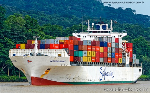
 MAERSK KANSAS
Current Status
Where is the vessel?
MAERSK KANSAS is currently in 20 nm NE of Jensen Beach, based on AIS data received about 2h ago.
Latest AIS update:
Current position: 27.41667° N, 79.90667° W (20 nm NE of Jensen Beach)
Average speed (last 7 days): Loading…
Average speed (last 30 days): Loading…
Vessel profile: MAERSK KANSAS is a Container Ship with dimensions 292m x 292m.
This page combines live AIS, route history, probable destination signals, nearby traffic, and port activity for practical vessel monitoring.
The current position of vessel MAERSK KANSAS is 27.41667 lat / -79.90667 lng. Updated: 2026-03-29 03:31:39 UTCNearest reference points:
- Near Saint Lucie
- Near Palm City
- Near Juno Beach
Currently sailing under the flag of United States of America ![]()
MAERSK KANSAS built in 2007 year
Deadweight:
61447 tDetails:
Live Vessel MAERSK KANSAS Analytics (details, animations, etc.)
Recent AIS points (UTC):
2026-03-28 21:36:52 UTC · 28.54167, -80.06667 · SOG 16 kn · COG -1°2026-03-28 23:58:09 UTC · 27.96333, -80.00167 · SOG 14 kn · COG -1°
2026-03-29 00:40:17 UTC · 27.80167, -79.97333 · SOG 14 kn · COG -1°
2026-03-29 03:31:39 UTC · 27.41667, -79.90667 · SOG 13 kn · COG -1°