 vesseltracker.com
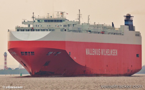
 Talia
Talia
Current Status
Where is the vessel?
Talia is currently in 10 nm NE of DAESAN, based on AIS data received about 1h ago.
Latest AIS update:
Current position: 37.12404° N, 126.54891° E (10 nm NE of DAESAN)
Average speed (last 7 days): Loading…
Average speed (last 30 days): Loading…
Vessel profile: Talia is a Vehicles Carrier with dimensions 200m x 32m.
This page combines live AIS, route history, probable destination signals, nearby traffic, and port activity for practical vessel monitoring.
The current position of vessel Talia is 37.12404 lat / 126.54891 lng. Updated: 2026-04-03 11:38:46 UTCNearest reference points:
- 10 nm N of DAESAN
- Near DAESAN
- Near Dangjin
Currently sailing under the flag of Bahamas ![]()
Talia built in 2006 year
Deadweight:
21021 tDetails:
Live Vessel Talia Analytics (details, animations, etc.)
Recent AIS points (UTC):
2026-04-03 06:18:09 UTC · 36.46609, 125.77205 · SOG 12.2 kn · COG 75°2026-04-03 08:22:08 UTC · 36.86733, 126.06069 · SOG 14.7 kn · COG 31°
2026-04-03 10:11:50 UTC · 37.05220, 126.28831 · SOG 0.2 kn · COG 63°
2026-04-03 11:38:46 UTC · 37.12404, 126.54891 · SOG 12.4 kn · COG 122°