 vesseltracker.com
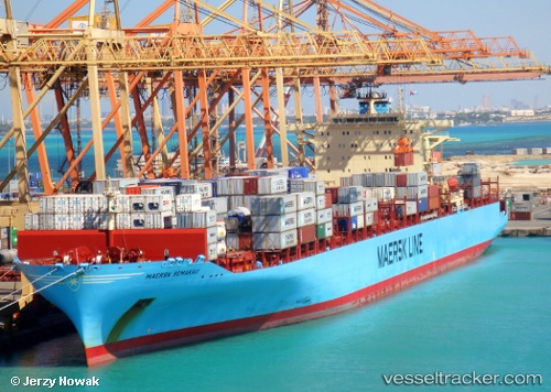
Maersk Semakau
Current StatusWhere is the vessel?
Maersk Semakau is currently in 181 nm SW of Stenhouse Bay, based on AIS data received about 1h ago.
Latest AIS update:
Current position: 37.89466° S, 135.10316° E (181 nm SW of Stenhouse Bay)
Average speed (last 7 days): Loading…
Average speed (last 30 days): Loading…
Vessel profile: Maersk Semakau is a Container Ship with dimensions 40m x 319m.
This page combines live AIS, route history, probable destination signals, nearby traffic, and port activity for practical vessel monitoring.
The current position of vessel Maersk Semakau is -37.89466 lat / 135.10316 lng. Updated: 2026-03-29 11:33:34 UTCDetails:
Live Vessel Maersk Semakau Analytics (details, animations, etc.)
Recent AIS points (UTC):
2026-03-29 05:26:05 UTC · -37.68333, 133.39000 · SOG 14 kn · COG -1°2026-03-29 07:35:59 UTC · -37.76109, 134.00575 · SOG 13.4 kn · COG 98°
2026-03-29 10:07:27 UTC · -37.84903, 134.70802 · SOG 13.4 kn · COG 98°
2026-03-29 11:33:34 UTC · -37.89466, 135.10316 · SOG 13.3 kn · COG 98°