 vesseltracker.com
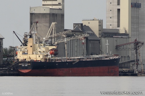
 TIANA
TIANA
Current Status
Where is the vessel?
TIANA is currently in Near Amlwch, based on AIS data received about 3h ago.
Latest AIS update:
Current position: 53.43728° N, 4.15653° W (Near Amlwch)
Average speed (last 7 days): Loading…
Average speed (last 30 days): Loading…
Vessel profile: TIANA is a Bulk Carrier with dimensions m x m.
This page combines live AIS, route history, probable destination signals, nearby traffic, and port activity for practical vessel monitoring.
The current position of vessel TIANA is 53.43728 lat / -4.15653 lng. Updated: 2026-03-28 21:53:12 UTCNearest reference points:
- Near Conwy (Conway)
- Near Rhôs-on-Sea
- Near Holyhead
Currently sailing under the flag of Marshall Islands ![]()
Details:
Live Vessel TIANA Analytics (details, animations, etc.)
Recent AIS points (UTC):
2026-03-28 16:12:07 UTC · 53.43482, -4.14878 · SOG 0.3 kn · COG -1°2026-03-28 18:23:11 UTC · 53.43487, -4.14866 · SOG 0.2 kn · COG 307°
2026-03-28 19:48:37 UTC · 53.43333, -4.14833 · SOG 0 kn · COG -1°
2026-03-28 21:53:12 UTC · 53.43728, -4.15653 · SOG 0.2 kn · COG 64°