 RMS ROSE
Current Status
Where is the vessel?
RMS ROSE is currently in 15 nm N of Torre Faro, based on AIS data received about 14h ago.
Latest AIS update:
Current position: 38.48974° N, 15.56815° E (15 nm N of Torre Faro)
Average speed (last 7 days): Loading…
Average speed (last 30 days): Loading…
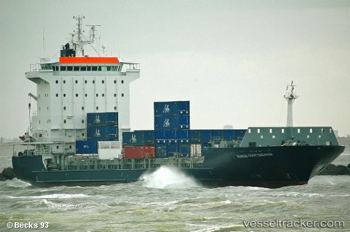
Vessel profile: RMS ROSE is a Container Ship with dimensions m x m.
This page combines live AIS, route history, probable destination signals, nearby traffic, and port activity for practical vessel monitoring.
The current position of vessel RMS ROSE is 38.48974 lat / 15.56815 lng. Updated: 2026-05-24 09:30:55 UTCNearest reference points:
- 13 nm N of Rometta Marea
- Near Torre Faro
- Near Messina
Currently sailing under the flag of Barbados ![]()
Details:
Live Vessel RMS ROSE Analytics (details, animations, etc.)
Recent AIS points (UTC):
2026-05-24 05:40:54 UTC · 39.29525, 15.18637 · SOG 13.3 kn · COG 160°2026-05-24 07:19:35 UTC · 38.94790, 15.34827 · SOG 13.6 kn · COG 162°
2026-05-24 07:42:15 UTC · 38.86988, 15.39269 · SOG 13.4 kn · COG 158°
2026-05-24 09:30:55 UTC · 38.48974, 15.56815 · SOG 13.1 kn · COG 158°