 vesseltracker.com
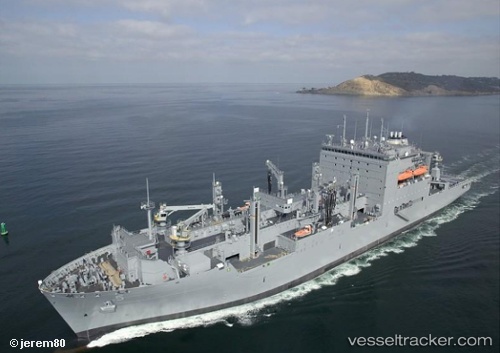
Robert E. Peary
Current StatusWhere is the vessel?
Robert E. Peary is currently in 22 nm S of Guanica, based on AIS data received about 3d ago.
Latest AIS update:
Current position: 17.60125° N, 66.96963° W (22 nm S of Guanica)
Average speed (last 7 days): Loading…
Average speed (last 30 days): Loading…
Vessel profile: Robert E. Peary is a Multi Purpose Carrier with dimensions 32m x 210m.
This page combines live AIS, route history, probable destination signals, nearby traffic, and port activity for practical vessel monitoring.
The current position of vessel Robert E. Peary is 17.60125 lat / -66.96963 lng. Updated: 2026-03-22 22:41:35 UTCNearest reference points:
- Near Guanica
- 82 nm S of Santa Isabel
- Near San Juan
Details:
Live Vessel Robert E. Peary Analytics (details, animations, etc.)
Recent AIS points (UTC):
2026-03-22 21:28:40 UTC · 17.67889, -66.82183 · SOG 10.9 kn · COG 242°2026-03-22 22:41:35 UTC · 17.60125, -66.96963 · SOG 10.7 kn · COG 240°
2026-03-22 22:41:35 UTC · 17.60125, -66.96963 · SOG 10.7 kn · COG 240°
2026-03-22 22:41:35 UTC · 17.60125, -66.96963 · SOG 10.7 kn · COG 240°