 vesseltracker.com
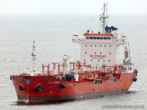
Sea Power
Current StatusWhere is the vessel?
Sea Power is currently in Near Lome, based on AIS data received about 2h ago.
Latest AIS update:
Current position: 6.05238° N, 1.25268° E (Near Lome)
Average speed (last 7 days): Loading…
Average speed (last 30 days): Loading…
Vessel profile: Sea Power is a Chemical Oil Products Tanker with dimensions 20m x 128m.
This page combines live AIS, route history, probable destination signals, nearby traffic, and port activity for practical vessel monitoring.
The current position of vessel Sea Power is 6.05238 lat / 1.25268 lng. Updated: 2026-04-01 09:21:55 UTCNearest reference points:
- Near Ablogamé
- Near Cotonou
- Near Kirikiri
Details:
Live Vessel Sea Power Analytics (details, animations, etc.)
Recent AIS points (UTC):
2026-04-01 04:07:55 UTC · 6.05167, 1.25167 · SOG 0 kn · COG -1°2026-04-01 05:22:05 UTC · 6.05145, 1.25326 · SOG 0.2 kn · COG 295°
2026-04-01 07:51:57 UTC · 6.05183, 1.25321 · SOG 0.2 kn · COG 271°
2026-04-01 09:21:55 UTC · 6.05238, 1.25268 · SOG 0.2 kn · COG 239°