 vesseltracker.com
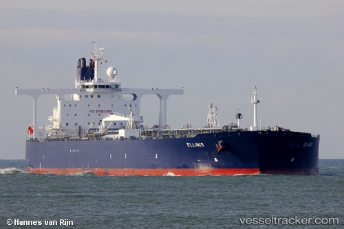
 SAHARA
Current Status
Where is the vessel?
SAHARA is currently in Near Ras Sudr, based on AIS data received less than 1h ago.
Latest AIS update:
Current position: 29.71040° N, 32.58145° E (Near Ras Sudr)
Average speed (last 7 days): Loading…
Average speed (last 30 days): Loading…
Vessel profile: SAHARA is a Crude Oil Tanker with dimensions m x m.
This page combines live AIS, route history, probable destination signals, nearby traffic, and port activity for practical vessel monitoring.
The current position of vessel SAHARA is 29.71040 lat / 32.58145 lng. Updated: 2026-03-31 11:21:04 UTCNearest reference points:
- Near Ras Sudr
- Near Al Adabiyah
- Near Bur Ibrahim
Currently sailing under the flag of Guinea-Bissau ![]()
Details:
Live Vessel SAHARA Analytics (details, animations, etc.)
Recent AIS points (UTC):
2026-03-31 05:36:03 UTC · 29.70877, 32.58047 · SOG 0 kn · COG 98°2026-03-31 08:09:08 UTC · 29.71010, 32.58090 · SOG 0 kn · COG 124°
2026-03-31 09:57:04 UTC · 29.71007, 32.58087 · SOG 0 kn · COG 126°
2026-03-31 11:21:04 UTC · 29.71040, 32.58145 · SOG 0 kn · COG 135°