 vesseltracker.com
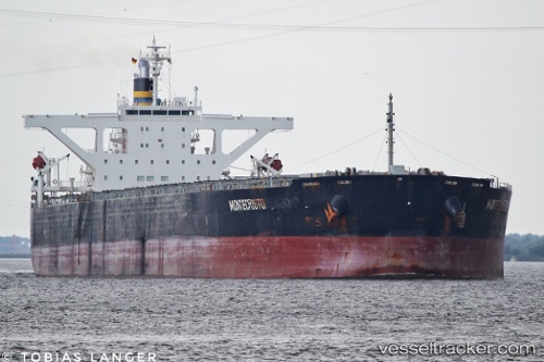
 MONTECRISTO
Current Status
Where is the vessel?
MONTECRISTO is currently in 29 nm W of Kommetjie, based on AIS data received less than 1h ago.
Latest AIS update:
Current position: 34.29121° S, 17.75938° E (29 nm W of Kommetjie)
Average speed (last 7 days): Loading…
Average speed (last 30 days): Loading…
Vessel profile: MONTECRISTO is a Bulk Carrier with dimensions m x m.
This page combines live AIS, route history, probable destination signals, nearby traffic, and port activity for practical vessel monitoring.
The current position of vessel MONTECRISTO is -34.29121 lat / 17.75938 lng. Updated: 2026-04-05 21:28:20 UTCNearest reference points:
- 18 nm SW of Cape Of Good Hope
- 12 nm W of ROBBEN ISLAND
- Near HOUT BAY
Currently sailing under the flag of Liberia ![]()
Details:
Live Vessel MONTECRISTO Analytics (details, animations, etc.)
Recent AIS points (UTC):
2026-04-05 16:09:30 UTC · -34.67744, 17.76225 · SOG 5.2 kn · COG 345°2026-04-05 17:40:00 UTC · -34.56570, 17.75521 · SOG 4.2 kn · COG 350°
2026-04-05 19:41:39 UTC · -34.42679, 17.75416 · SOG 4.7 kn · COG 26°
2026-04-05 21:28:20 UTC · -34.29121, 17.75938 · SOG 5 kn · COG 343°