 vesseltracker.com
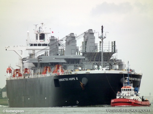
Hokuetsu Hope 2
Current StatusWhere is the vessel?
Hokuetsu Hope 2 is currently in 33 nm S of SATTAHIP, based on AIS data received less than 1h ago.
Latest AIS update:
Current position: 12.08994° N, 100.95395° E (33 nm S of SATTAHIP)
Average speed (last 7 days): Loading…
Average speed (last 30 days): Loading…
Vessel profile: Hokuetsu Hope 2 is a Wood Chips Carrier with dimensions 32m x 210m.
This page combines live AIS, route history, probable destination signals, nearby traffic, and port activity for practical vessel monitoring.
The current position of vessel Hokuetsu Hope 2 is 12.08994 lat / 100.95395 lng. Updated: 2026-04-09 12:20:14 UTCNearest reference points:
- 33 nm S of SATTAHIP
- 11 nm S of Map Ta Phut
- Near SATTAHIP
Details:
Live Vessel Hokuetsu Hope 2 Analytics (details, animations, etc.)
Recent AIS points (UTC):
2026-04-09 05:52:05 UTC · 10.90577, 101.78835 · SOG 12.5 kn · COG 324°2026-04-09 07:48:22 UTC · 11.25205, 101.54758 · SOG 13.3 kn · COG 324°
2026-04-09 09:28:23 UTC · 11.56166, 101.33491 · SOG 13.4 kn · COG 324°
2026-04-09 12:20:14 UTC · 12.08994, 100.95395 · SOG 13.4 kn · COG 309°