 vesseltracker.com
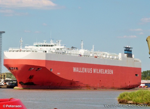
Tarifa
Current StatusWhere is the vessel?
Tarifa is currently in Near Rio Grande, based on AIS data received about 1h ago.
Latest AIS update:
Current position: 32.04172° S, 52.07474° W (Near Rio Grande)
Average speed (last 7 days): Loading…
Average speed (last 30 days): Loading…
Vessel profile: Tarifa is a Vehicles Carrier with dimensions 30m x 200m.
This page combines live AIS, route history, probable destination signals, nearby traffic, and port activity for practical vessel monitoring.
The current position of vessel Tarifa is -32.04172 lat / -52.07474 lng. Updated: 2026-04-08 15:27:09 UTCNearest reference points:
- Near Rio Grande
- 24 nm SE of São José do Norte
- 55 nm SE of Chui
Details:
Live Vessel Tarifa Analytics (details, animations, etc.)
Recent AIS points (UTC):
2026-04-08 09:48:27 UTC · -32.04167, -52.07333 · SOG 0 kn · COG -1°2026-04-08 11:51:24 UTC · -32.04167, -52.07333 · SOG 0 kn · COG -1°
2026-04-08 13:54:07 UTC · -32.04174, -52.07475 · SOG 0 kn · COG 164°
2026-04-08 15:27:09 UTC · -32.04172, -52.07474 · SOG 0 kn · COG 164°