 vesseltracker.com
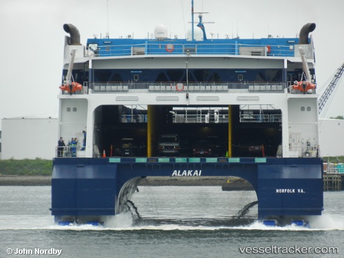
 ALAKAI
Current Status
Where is the vessel?
ALAKAI is currently in Near Charleston Heights, based on AIS data received about 1h ago.
Latest AIS update:
Current position: 32.85894° N, 79.95825° W (Near Charleston Heights)
Average speed (last 7 days): Loading…
Average speed (last 30 days): Loading…
Vessel profile: ALAKAI is a Passenger/Ro-Ro Ship (vehicles) with dimensions m x m.
This page combines live AIS, route history, probable destination signals, nearby traffic, and port activity for practical vessel monitoring.
The current position of vessel ALAKAI is 32.85894 lat / -79.95825 lng. Updated: 2026-03-27 20:17:57 UTCNearest reference points:
- Near Charleston
- 33 nm S of Kiawah Island
- Near Saint Andrews
Currently sailing under the flag of United States of America ![]()
ALAKAI built in 2007 year
Deadweight:
936 tDetails:
Live Vessel ALAKAI Analytics (details, animations, etc.)
Recent AIS points (UTC):
2026-03-27 13:23:57 UTC · 32.85894, -79.95825 · SOG 0 kn · COG 285°2026-03-27 15:30:03 UTC · 32.85894, -79.95825 · SOG 0 kn · COG 285°
2026-03-27 17:44:57 UTC · 32.85894, -79.95824 · SOG 0 kn · COG 284°
2026-03-27 20:17:57 UTC · 32.85894, -79.95825 · SOG 0 kn · COG 284°