 vesseltracker.com
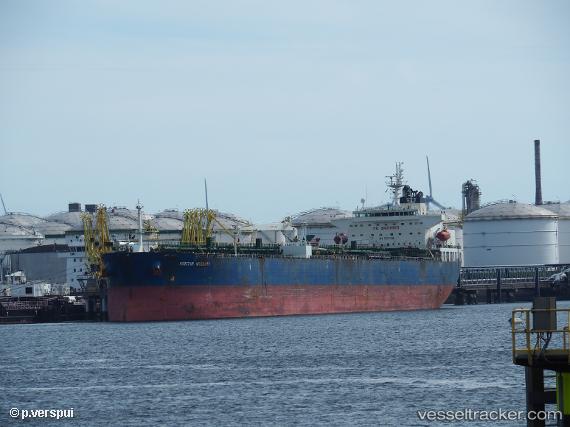
 AMI
AMI
Current Status
Where is the vessel?
AMI is currently in Near Le Grazie, based on AIS data received about 2h ago.
Latest AIS update:
Current position: 44.06538° N, 9.83597° E (Near Le Grazie)
Average speed (last 7 days): Loading…
Average speed (last 30 days): Loading…
Vessel profile: AMI is a Crude Oil Tanker with dimensions m x m.
This page combines live AIS, route history, probable destination signals, nearby traffic, and port activity for practical vessel monitoring.
The current position of vessel AMI is 44.06538 lat / 9.83597 lng. Updated: 2026-04-01 15:20:40 UTCNearest reference points:
- Near La Spezia
- Near Ortonova, Isola
- Near Vernazza
Currently sailing under the flag of Cook Islands ![]()
Details:
Live Vessel AMI Analytics (details, animations, etc.)
Recent AIS points (UTC):
2026-04-01 09:23:31 UTC · 44.06541, 9.83595 · SOG 0 kn · COG -1°2026-04-01 11:53:30 UTC · 44.06539, 9.83596 · SOG 0 kn · COG -1°
2026-04-01 13:53:31 UTC · 44.06540, 9.83597 · SOG 0 kn · COG -1°
2026-04-01 15:20:40 UTC · 44.06538, 9.83597 · SOG 0 kn · COG -1°