 vesseltracker.com
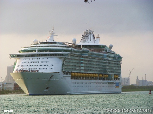
 Liberty Of The Seas
Current Status
Where is the vessel?
Liberty Of The Seas is currently in 14 nm E of Great Harbour Cay, based on AIS data received less than 1h ago.
Latest AIS update:
Current position: 25.67872° N, 77.57920° W (14 nm E of Great Harbour Cay)
Average speed (last 7 days): Loading…
Average speed (last 30 days): Loading…
Vessel profile: Liberty Of The Seas is a Cruise Ship with dimensions 339m x 38m.
This page combines live AIS, route history, probable destination signals, nearby traffic, and port activity for practical vessel monitoring.
The current position of vessel Liberty Of The Seas is 25.67872 lat / -77.57920 lng. Updated: 2026-03-29 07:22:12 UTCNearest reference points:
- 27 nm SE of Gorda Cay
- Near Nassau
- Near Lyford Cay
Currently sailing under the flag of Bahamas ![]()
Liberty Of The Seas built in 2007 year
Deadweight:
10600 tDetails:
Live Vessel Liberty Of The Seas Analytics (details, animations, etc.)
Recent AIS points (UTC):
2026-03-29 00:40:13 UTC · 25.32230, -77.42537 · SOG 3.2 kn · COG 358°2026-03-29 03:32:13 UTC · 25.42437, -77.46043 · SOG 3.3 kn · COG 4°
2026-03-29 06:15:06 UTC · 25.55813, -77.51388 · SOG 7 kn · COG 342°
2026-03-29 07:22:12 UTC · 25.67872, -77.57920 · SOG 7 kn · COG 336°