 vesseltracker.com
 JIUYANG BONANZA
Current Status
Where is the vessel?
JIUYANG BONANZA is currently in 18 nm W of Hulaylah Terminal, based on AIS data received about 1h ago.
Latest AIS update:
Current position: 25.99392° N, 55.59442° E (18 nm W of Hulaylah Terminal)
Average speed (last 7 days): Loading…
Average speed (last 30 days): Loading…
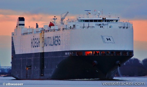
Vessel profile: JIUYANG BONANZA is a Vehicles Carrier with dimensions m x m.
This page combines live AIS, route history, probable destination signals, nearby traffic, and port activity for practical vessel monitoring.
The current position of vessel JIUYANG BONANZA is 25.99392 lat / 55.59442 lng. Updated: 2026-03-28 20:06:57 UTCNearest reference points:
- 13 nm NW of Hulaylah Terminal
- Near Hulaylah Terminal
- 20 nm NW of Hulaylah Terminal
Currently sailing under the flag of Marshall Islands ![]()
Details:
Live Vessel JIUYANG BONANZA Analytics (details, animations, etc.)
Recent AIS points (UTC):
2026-03-28 13:21:57 UTC · 25.95569, 55.59767 · SOG 2.1 kn · COG 329°2026-03-28 16:01:27 UTC · 26.02785, 55.63872 · SOG 1.8 kn · COG 314°
2026-03-28 17:42:28 UTC · 26.07526, 55.64126 · SOG 3.1 kn · COG 231°
2026-03-28 20:06:57 UTC · 25.99392, 55.59442 · SOG 1.6 kn · COG 317°