 vesseltracker.com
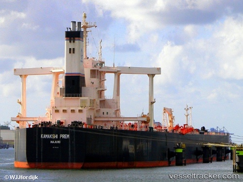
 PAPA
PAPA
Current Status
Where is the vessel?
PAPA is currently in 11 nm E of Dung Quat Petroleum Port, based on AIS data received about 13d ago.
Latest AIS update:
Current position: 15.29894° N, 109.03297° E (11 nm E of Dung Quat Petroleum Port)
Average speed (last 7 days): Loading…
Average speed (last 30 days): Loading…
Vessel profile: PAPA is a Crude Oil Tanker with dimensions 60m x 333m.
This page combines live AIS, route history, probable destination signals, nearby traffic, and port activity for practical vessel monitoring.
The current position of vessel PAPA is 15.29894 lat / 109.03297 lng. Updated: 2026-04-09 01:38:18 UTCNearest reference points:
- Near DUNG QUAT
- Near Thuan An
- 17 nm NE of Bong Son
Currently sailing under the flag of Panama ![]()
PAPA built in 2006 year
Deadweight:
299235 tDetails:
Live Vessel PAPA Analytics (details, animations, etc.)
Recent AIS points (UTC):
2026-04-09 01:38:18 UTC · 15.29894, 109.03297 · SOG 4 kn · COG 336°2026-04-09 01:38:18 UTC · 15.29894, 109.03297 · SOG 4 kn · COG 336°
2026-04-09 01:38:18 UTC · 15.29894, 109.03297 · SOG 4 kn · COG 336°