 vesseltracker.com
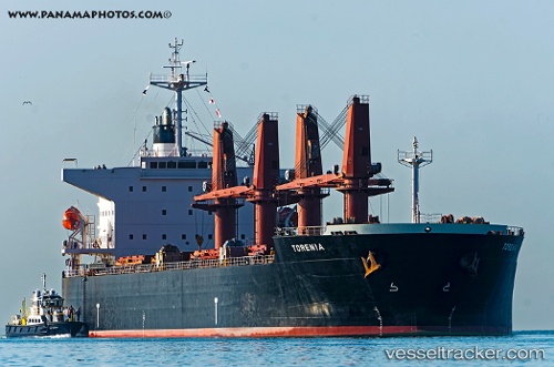
 TAXIDIARA
Current Status
Where is the vessel?
TAXIDIARA is currently in 387 nm N of Fernando De Noronha, based on AIS data received about 1h ago.
Latest AIS update:
Current position: 2.45843° N, 30.98830° W (387 nm N of Fernando De Noronha)
Average speed (last 7 days): Loading…
Average speed (last 30 days): Loading…
Vessel profile: TAXIDIARA is a Bulk Carrier with dimensions 32m x 190m.
This page combines live AIS, route history, probable destination signals, nearby traffic, and port activity for practical vessel monitoring.
The current position of vessel TAXIDIARA is 2.45843 lat / -30.9883 lng. Updated: 2026-03-29 11:23:28 UTCNearest reference points:
- Open sea, approx. 403 nm off the nearest listed port
- Open sea, approx. 400 nm off the nearest listed port
- Open sea, approx. 416 nm off the nearest listed port
Currently sailing under the flag of Malta ![]()
TAXIDIARA built in 2007 year
Deadweight:
56049 tDetails:
Live Vessel TAXIDIARA Analytics (details, animations, etc.)
Recent AIS points (UTC):
2026-03-29 05:34:44 UTC · 3.58742, -30.59610 · SOG 12.1 kn · COG 194°2026-03-29 08:18:24 UTC · 3.05984, -30.77290 · SOG 12.1 kn · COG 196°
2026-03-29 09:36:37 UTC · 2.80500, -30.85830 · SOG 12 kn · COG -1°
2026-03-29 11:23:28 UTC · 2.45843, -30.98830 · SOG 12.5 kn · COG 199°