 vesseltracker.com
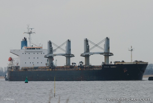
 FUDA
FUDA
Current Status
Where is the vessel?
FUDA is currently in 374 nm W of Henties Bay (Hentiesbaai), based on AIS data received about 1h ago.
Latest AIS update:
Current position: 22.27552° S, 7.55062° E (374 nm W of Henties Bay (Hentiesbaai))
Average speed (last 7 days): Loading…
Average speed (last 30 days): Loading…
Vessel profile: FUDA is a Bulk Carrier with dimensions 32m x 190m.
This page combines live AIS, route history, probable destination signals, nearby traffic, and port activity for practical vessel monitoring.
The current position of vessel FUDA is -22.27552 lat / 7.55062 lng. Updated: 2026-04-01 22:05:52 UTCNearest reference points:
- Open sea, approx. 431 nm off the nearest listed port
- Open sea, approx. 433 nm off the nearest listed port
- Open sea, approx. 441 nm off the nearest listed port
Currently sailing under the flag of Panama ![]()
FUDA built in 2007 year
Deadweight:
56039 tDetails:
Live Vessel FUDA Analytics (details, animations, etc.)
Recent AIS points (UTC):
2026-04-01 15:21:54 UTC · -23.29901, 8.37708 · SOG 11.7 kn · COG 323°2026-04-01 17:30:20 UTC · -22.97372, 8.11433 · SOG 11 kn · COG 324°
2026-04-01 19:41:45 UTC · -22.64007, 7.83998 · SOG 11.3 kn · COG 322°
2026-04-01 22:05:52 UTC · -22.27552, 7.55062 · SOG 11.3 kn · COG 322°